
Dry Days / No Alcohol Days in Delhi Delhi is a bustling metropolis with a vibrant culture and a diverse population. However, there are certain days of the year when the city observes dry days, during which the sale and consumption of alcohol are prohibited. These dry days are typically observed on important national and […]
Main Content
Information
Delhi Premium Buses: Book Online through App Only
Delhi’s App-Based Premium Buses Seat reservations are now set to take place prior to departure as the path is paved for the implementation of the Premium Bus Aggregator Scheme in Delhi, following the issuance of a notification. Similar to how residents of Delhi-NCR currently book cabs, autos, or bike taxis via mobile apps, the ability […]
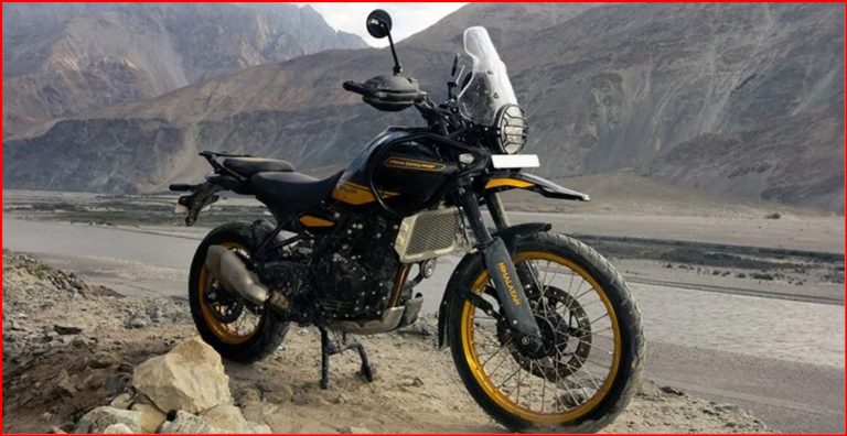
Royal Enfield Himalayan 450: Price and Technical Specifications
Himalayan 450 In the realm of adventure motorcycles, the Royal Enfield Himalayan 450 stands out as a capable and versatile machine, designed to tackle diverse terrains and conquer adventurous journeys. This robust motorcycle, an evolution of its predecessor, the Himalayan 411, boasts a refined engine, enhanced performance, and a range of features that make it […]
News
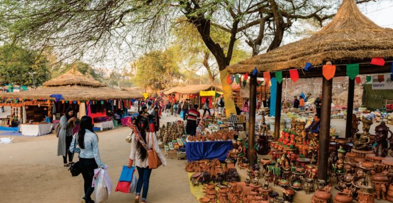
Surajkunar Craft Mela 2024 – Dates, Timing, Ticket Price, Schedule Events, How to Reach
Experience the vibrant celebrations & showcase of craft, textile, music, art, cultural heritage and artistic display of different cultures from India & across the globe at the world biggest craft fair – Surajkund Craft Mela. Held every year at Faridabad, Haryana – Surajkund Craft Mela is special because it serves as a bustling marketplace where […]
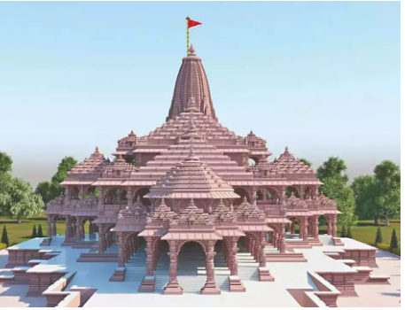
Government Schemes : Offering free visit to Ayodhya for Ram Lalla’s Darshan
In the next couple of weeks, Delhi BJP will take a total of 21000 people from different parts of the city to Ayodhya for free visit to Ram Lalla’s darshan. Delhi BJP spokesperson Praveen Shankar Kapoor said that the plan is to take 3000 people from each of the constituencies in Delhi – New Delhi, […]
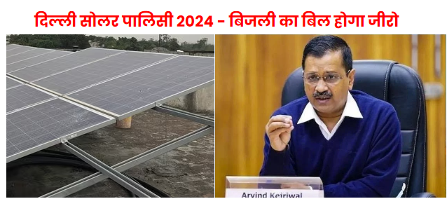
दिल्ली सोलर पालिसी 2024 – बिजली का बिल होगा जीरो
आइये आज बात करते हैं दिल्ली सरकार की ” सोलर पालिसी 2024 ” की. दिल्ली की अरविन्द केजरीवाल सरकार का ये दावा है कि नयी सोलर पालिसी 2024 के तहत दिल्ली क्षेत्र में रहने वाली आवासीय आबादी केl लगभग सभी परिवारों का बिजली का बिल जीरो हो जाएगा. यही नहीं, यहां तक कि ये भी […]

New Delhi World Book Fair 2024, Dates, Timings, Venue, Entry Fees
51st Edition of New Delhi World Book Fair 2024 If you love reading books, then it’s time of the year when you can block the date in advance for the upcoming, very famous, oldest and arguably one of the biggest book fairs in the world – New Delhi Wold Book Fair 2024 (NDWBF). New Delhi […]
Delhi Travel
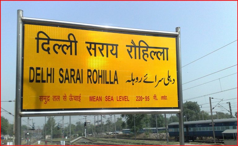
Sarai Rohilla Railway Station (DEE)
Delhi Sarai Rohilla Railway Station The Delhi Sarai Rohilla railway station (station code: DEE) is a major railway station in the Indian city of Delhi. It is situated about 4 kilometers (2.5 mi) from Old Delhi railway junction. The station is managed by the Delhi Division of Northern Railway zone. Many trains from Delhi to […]
Japanese Park Rohini Delhi: Ticket Price, and Timings
Japanese Park Japanese Park, also known as Swarn Jayanti Park, is a beautiful public park located in Sector 10, Rohini, Delhi. It is a popular spot for locals and tourists alike, offering a peaceful oasis from the hustle and bustle of the city. The park is inspired by traditional Japanese gardens, with lush green landscapes, […]
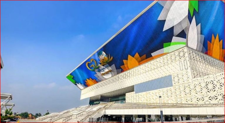
YashoBhoomi Delhi: Ticket Price, Online Booking, Timings, and Location
YashoBhoomi Delhi YashoBhoomi, also known as the India International Convention and Expo Center, is a state-of-the-art convention and exhibition center located in Dwarka, New Delhi, India. It is one of the largest MICE (Meetings, Incentives, Conferences, and Exhibitions) facilities in the world, with a total project area of over 8.9 lakh square meters and a […]
Delhi Locations
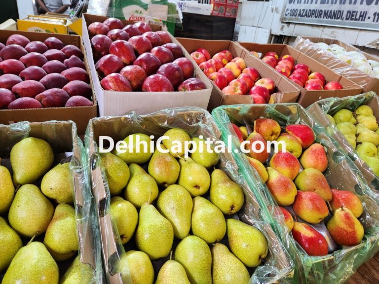
Azadpur Sabzi Mandi: The Largest Fruit and Vegetable Market in Asia
Azadpur Sabzi Mandi Nestled in the heart of Delhi, Azadpur Sabzi Mandi stands as a bustling testament to India’s agricultural prowess. This sprawling wholesale market, often referred to as the ‘lifeline of fresh produce,’ plays a vital role in connecting farmers from across the country with consumers in one of India’s largest metropolitan areas. With […]
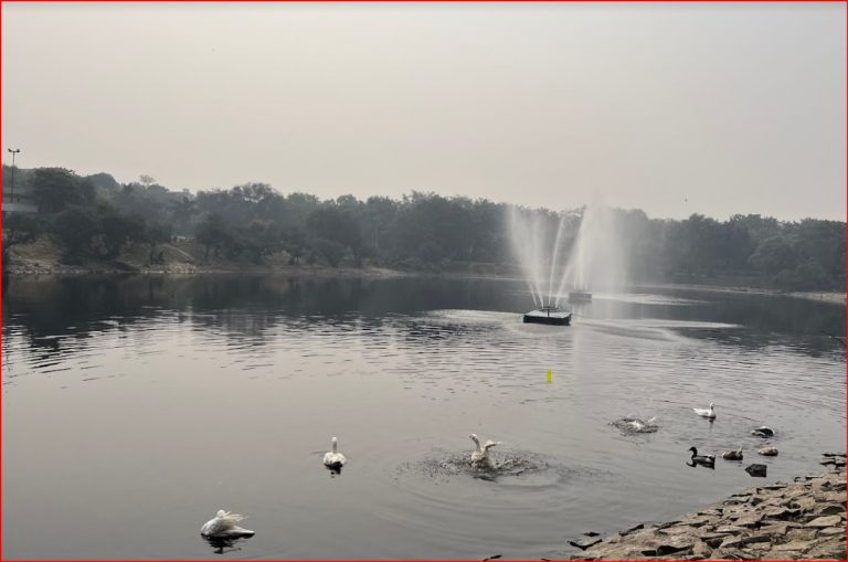
Japanese Park Delhi: Pictures, Operating Hours, Boating, and Lush Green Landscapes
Japanese Park Delhi Nestled within the vibrant heart of Delhi, Swarn Jayanti Park, commonly known as the Japanese Park Delhi, stands as an idyllic sanctuary where the grace of Japanese aesthetics merges seamlessly with the rich tapestry of Indian culture. This verdant oasis, with its luxuriant gardens, peaceful ponds, and painstakingly designed structures, provides a […]

Museum of Illusions New Delhi Tickets: Everything You Need to Know
If you’re looking for a unique and mind-bending experience in New Delhi, the Museum of Illusions is the perfect destination. With many exhibits that challenge your perceptions and trick your senses, this museum is unlike any other. Here’s everything you need to know about Museum of Illusions New Delhi tickets. Here you can have fun […]
Weather
Delhi’s Weather Whirlwind: Rain Alert Sparks December Dilemma!
Get ready for a meteorological rollercoaster in Delhi! The Meteorological Department just unleashed a rain alert, and the drama could linger until December. Cloudy skies, a hint of rain, and a foggy mystery. What’s Brewing in Delhi’s Skies? The weather wizards at the Meteorological Department have thrown a curveball – a rain alert that might […]
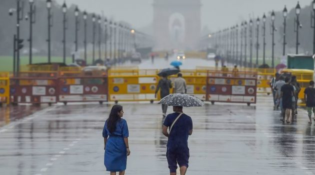
Delhi Rain Alert: Scorching Sun in Delhi, Know when will it Rain in Delhi
Delhi Weather Update After the respite due to rains in Delhi, people are again facing scorching heat. The standard observatory Safdarjung recorded a maximum temperature of 40.5 degrees Celsius on Friday, which was one degree above normal. While the minimum temperature was 27.3 degree Celsius. At the same time, in many areas the temperature crossed […]
Delhi Metro
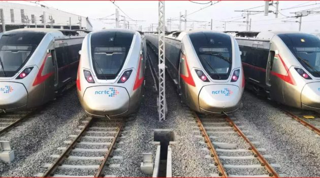
Easy Connectivity for Passengers between RRTS & Delhi Metro Stations
By early 2025, passengers can see the Namo Bharat RRTS and Delhi Metro trains cross crossing at New Ashok Nagar Metro station. The two trains will also cross each other at Ghaziabad. Both the trains will also traverse at Anand Vihar and Sarai Kale Khan. If we talk about Anand Vihar where the Metro station […]
Kirti Nagar to Noida Sector 18 Metro Station – Route, Train Timings & Ticket Price
Kirti Nagar to Noida Sector 18 Metro Station If you are planning to travel from Kirti Nagar to Noida Sector 18, then Delhi Metro provides you with a sustainable, hustle-free, traffic-free & economical option. Here are details about your upcoming journey. The Kirti Nagar metro station is located in the West Delhi district of Delhi. […]